ShopDreamUp AI ArtDreamUp
Deviation Actions


Suggested Deviants


Suggested Collections


You Might Like…


Description
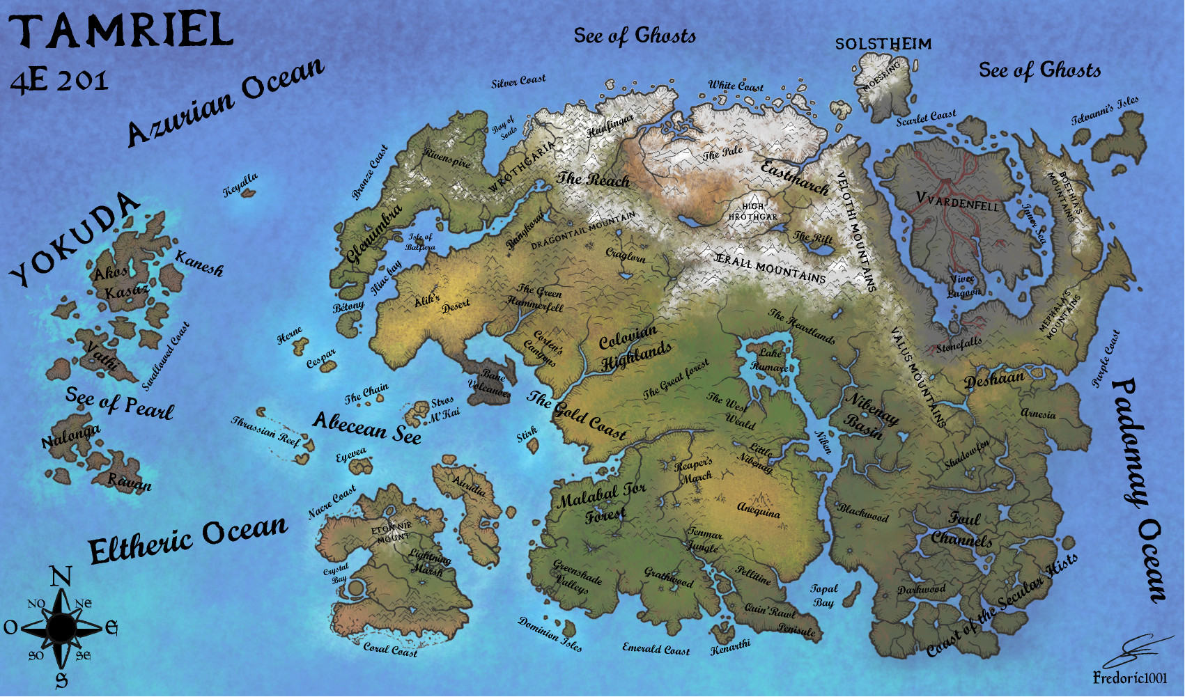
Geographic map of Tamriel, the Elder Scrolls continent, at the year 4E201
I tried to represent the climatic and geographic variation of the continent. you can see the ice and snow cover in the nort, the differents deserts, green forest, toundra in Skyrim ^^, hills, plains and rivers. I ad geographic names of the different regions, montains, forests coasts ...
It is my own interpretation after many hours playing the Elder Scrolls Games and DLCs, and using all official and unoffical information on the web
-> I used Gimp and Inkscape
Credits : Bethesda Softworks ^^
I'm open for any suggestion and comments ^^
Image size
1701x1001px 718.98 KB
© 2013 - 2024 fredoric1001
Comments3
Join the community to add your comment. Already a deviant? Log In
Really awesome map. Question about Yokuda, is it still there? I heard that there's still something out there.