ShopDreamUp AI ArtDreamUp
Deviation Actions


Suggested Deviants


Suggested Collections


You Might Like…


Description
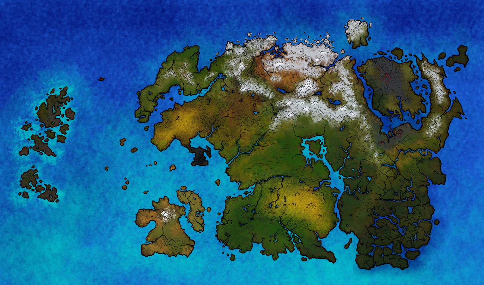
This is the map of Tamriel, the Elder Scrolls continent, before the Red Year (before the 4th Area)
I tried to represent the climatic and geographic variation of the continent. you can see the ice and snow cover in the nort, the differents deserts, green forest, toundra in Skyrim ^^, hills, plains and rivers. Ther is no country border, only nature ^^
Its a sort of satellite view ^^
It is my own interpretation after many hours playing Elder Scrolls game, and resaerch of information on the web
-> I used Gimp
Crédits : Bethesda Softworks ^^
Image size
1700x1000px 678.08 KB
© 2013 - 2024 fredoric1001
Comments2
Join the community to add your comment. Already a deviant? Log In
Great work you make amazing maps  (Smile)")